While Western civilization is globalizing, there are obvious lies that it tells to itself and to the world. It presents Ancient Greece as the birthplace of culture and art. At the same time, they disregard the Aztecs, Egypt and even the Chinese civilization, who had achieved much greater mathematical and artistic results even before. Likewise, our maps were produced with this fiction and are false. Let’s see the truth. Real world map.
The map below has received a new map and reward.

Let’s take a closer look.
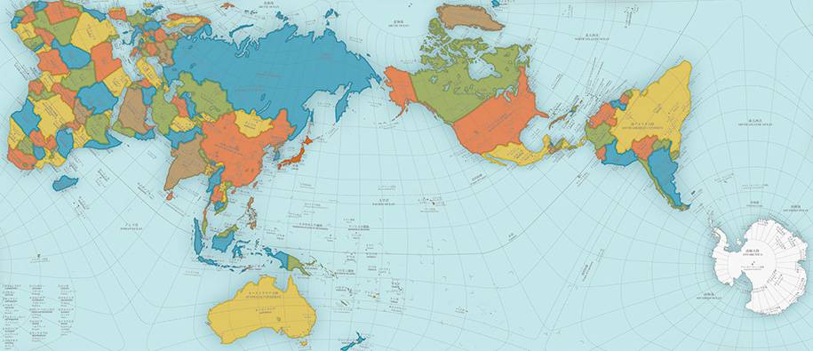
There is something strange about the size, right? How big is Africa? There must be a mistake. On the map we’ve seen in a lifetime, Africa was a small place down there. But not so now. Bigger than North America, bigger than Europe. Is Greenland that small?
It seems that the part of Asia with China has also expanded? The USA looks small compared to the old map as a country. Where is England, for God’s sake, how hard we have to find Great Britain.
What kind of world map is this? While “famous countries” are getting smaller, the countries that we shouldn’t see, remember, or think about what they go through in daily life have grown!
The map above was created by using a better method of rendering the globe (actually, not even a geoid, but a lump like a potato) on paper.
Print the map in large sizes and hang it in classrooms, homes, libraries. The world is really such children, young people and people who want to learn.
Now it’s time to throw away our pre-satellite maps produced in 1569 with Mercator Projection. If you are wondering how the concept of projection on world maps was produced: https://en.wikipedia.org/wiki/Map_projection
The production of the map is as follows:

THE TRUE SIZE – REAL SIZE
Shall we play a game together? I invite you to an interactive map.
Please click the link below. Choose a country of your choice and move it on the map. See with your own eyes how its greatness is distorted and deceptive by the method now used.
This is also a nice classroom activity that teachers can use to engage students. Besides, what day do smart boards and tablets stand for, right?
Our Site: http://thetruesize.com/
Think about it, a child thinks about the possibilities that can be done while thinking that his country is a small country since his childhood. When he grows up, he becomes a businessman, and when he becomes a thinker, this continues. Of course, it is more important to use that country efficiently than the size of the country. That should be the main starting point. Again, you are beginning to think that this map arrangement is not in vain.
Now it’s time for the designer to thank the person who prepared this map.
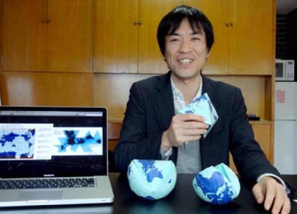
Japanese artist Hajime Narukawa, his map is called “AuthaGraph World Map”

The competition he won is Japan’s Good Design Awards
Description page: https://www.g-mark.org/award/describe/44527
Here’s how Narukawa explains his design:
Description on the map site:
http://www.authagraph.com/projects/description/%E3%80%90%E4%BD%9C%E5%93%81%E8%A7%A3%E8%AA%AC%E3 80%91%E8%A8%98%E4%BA%8B01/?lang=en
Let me summarize below.
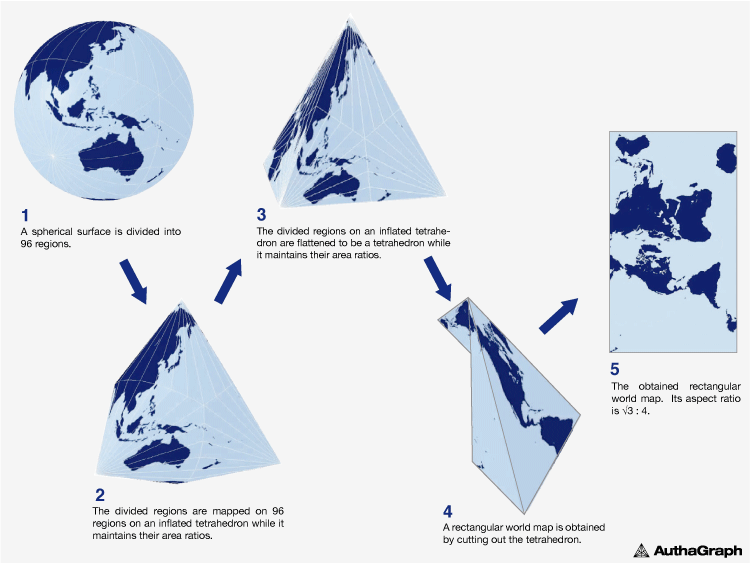
The globe is divided into 96 regions. These 96 split regions are rectified to become tetrahedrons. It is then reassembled in rectangular map form.
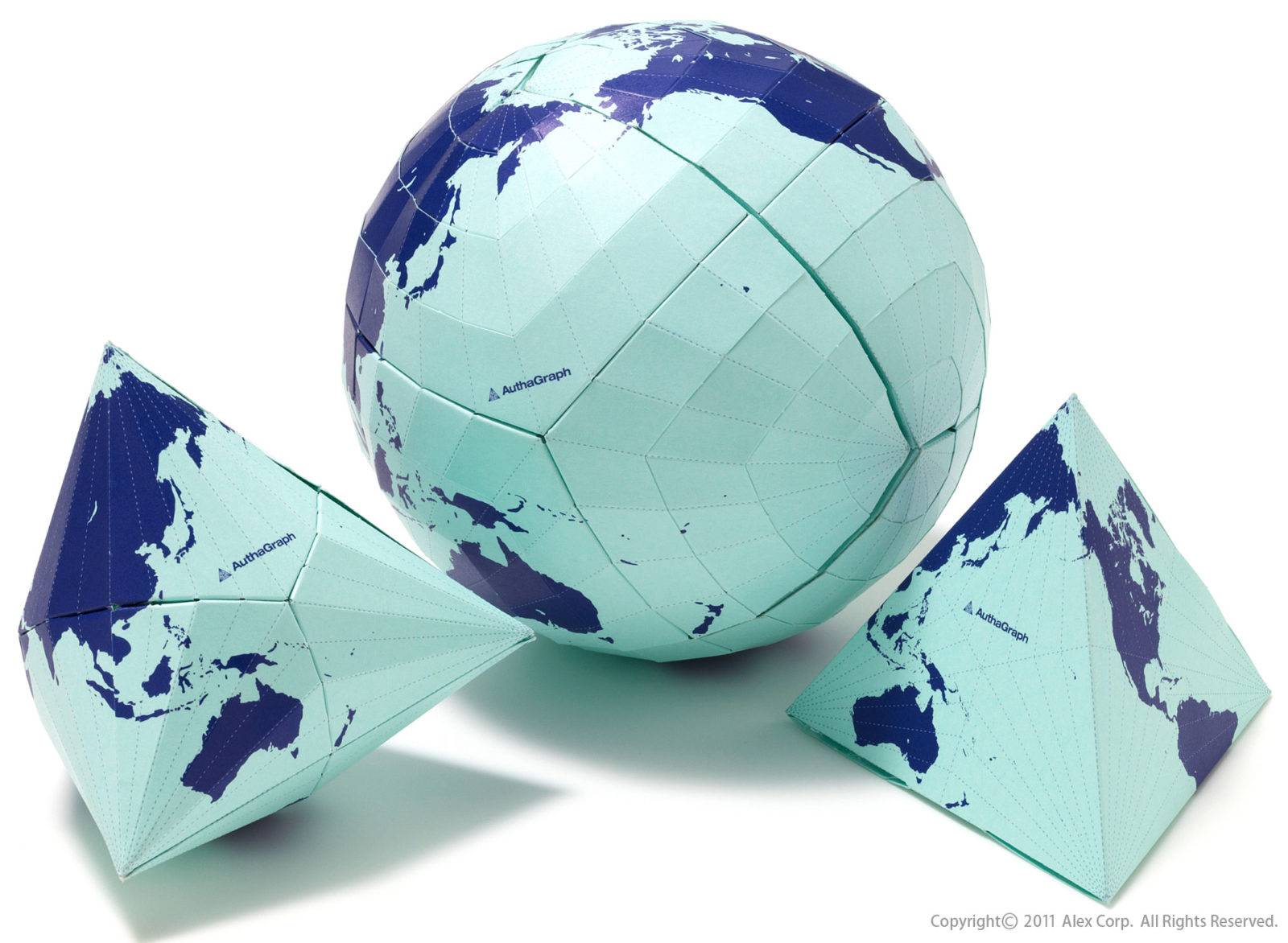
It is also possible to purchase the above product:
http://www.alexcious.com/products/detail151.html
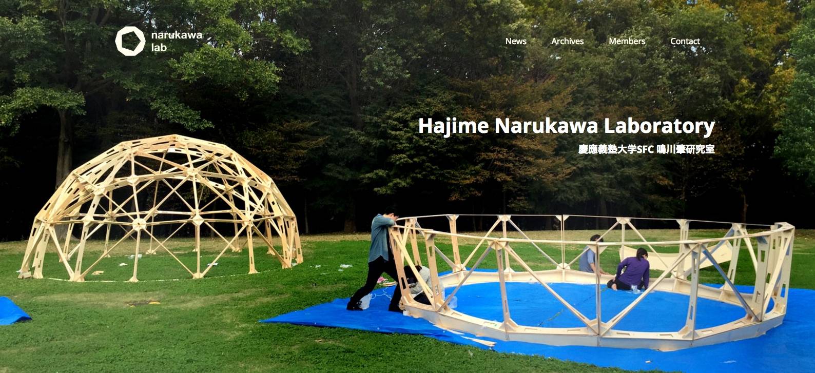
It has a different usage here:
http://narukawa-lab.jp/archives/authagraph-map/ Opened:

In 2015, this map was added to textbooks in high schools in Japan.
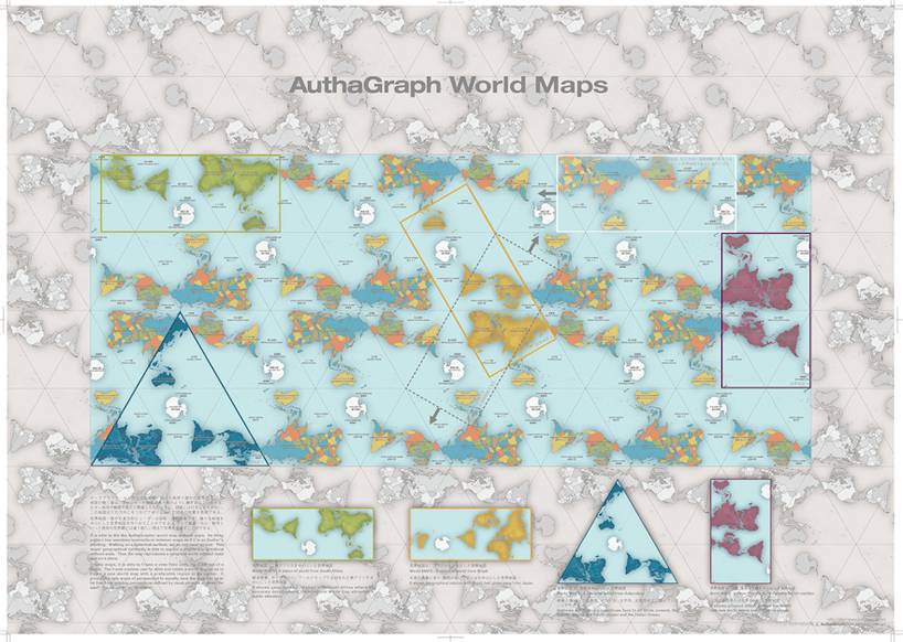
Here is the event:

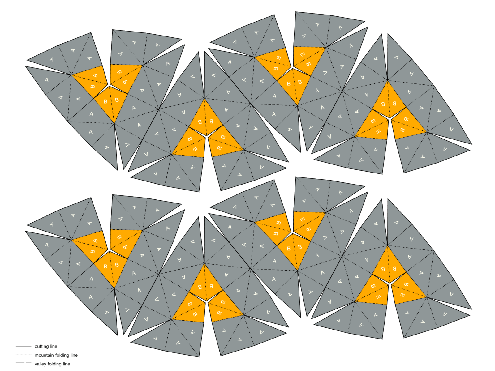
The gift of patience to those who have read this far, the image below does not consist of 96 parts, its 20-part name Dymaxion Map is still beautiful. Easier to do after all. (Buckminster Fuller patent holder – 1946)
Save the image. Print from the printer. Cut the edges. Stick it and your sphere is ready. If you like it, recommend it to your friends and announce it to the teachers. Share
(And of course, don’t forget to cite the source. The address of this page )

Click to download PDF Version: http://narukawa-lab.jp/?ddownload=4164
REFERENCES:
Wikipedia Authagraph Projection
https://en.wikipedia.org/wiki/Authagraph_projection
Official Site of the Map
http://www.authagraph.com/
Narukawa Lab
http://narukawa-lab.jp/archives/authagraph-map/
How big are countries actually?
http://www.boredpanda.com/true-size-countries-mercator-map-projection-james-talmage-damon-maneice/
